Continuing the Crook County News Since 1884
Continuing the Crook County News Since 1884
Late season blizzard brings northeast region to a standstill
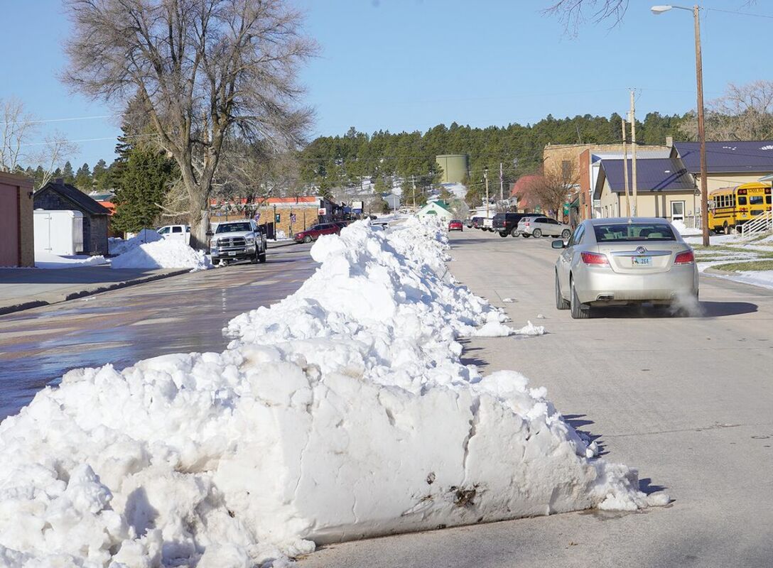
Though the snow melted almost as quickly as it fell, the evidence of this weekend's blizzard was still present on the city streets by Monday.
Drifts of snow block the door at a county residence as the storm comes to an end.
What began as a thunderstorm on Friday evening ended in the most significant blizzard so far this season, bringing travel to a standstill, canceling events and cutting power in some places across the area.
It turned out to be a much more severe blizzard than many had been expecting. According to the National Weather Service, a low pressure system approached the plains on Friday, pushing warm, moist air ahead of it.
This caused thunderstorms to develop on Friday evening, which became severe in some places – mostly in South Dakota – and brought large hail and strong winds. Some places received up to two inches of rain.
As the storms moved eastward and dissipated, they were followed on Saturday morning by more precipitation – this time, snow. Winds from the northwest gathered strength and gusted to more than 70 mph in some places, which combined with the snow to create hazardous travel conditions and poor visibility.
Not everywhere saw heavy snow, while in some places the snowmelt outpaced the fall, but the winds caused blizzard conditions almost everywhere.
The highest snowfall reported was in downtown Gillette, which saw 22 inches. In Crook County, the highest recorded snowfall was four miles south of Devils Tower, where 15 inches fell.
The Hulett area saw between eight and 12 inches of snow, while Sundance saw six to eight inches. Six inches of snow fell in Moorcroft and four inches in Beulah.
Rapid City caught the brunt of the wind, with 76 mph gusts recorded downtown and at the airport. In Wyoming, Wright saw 72 mph winds.
Closer to home, winds of 56 mph were recorded in Rozet, 53 mph in Beulah and 50 mph east-southeast of Pine Haven.
No hail was recorded on the Wyoming side of the border during the thunderstorms. In South Dakota, Cottonwood experienced 3.5-inch hailstones.
Roads began closing early on Saturday morning. Operators did their best to open them, but the heavy, wet snow and high winds created drifts it proved impossible to clear.
By 11 a.m. on Saturday, as the storm raged on, WYnDOT had made the decision to close I-90 out of Gillette, US 14 and WYO 116 west out of Sundance due to high traffic volumes. Traffic was backlogged at Moorcroft with limited accommodations for the stranded.
By the evening, almost every road in WYDOT District 4 was closed, with no estimates for opening. The closures continued well into Sunday, with I-90 only fully opening mid-afternoon.
Other highways fared worse. WYDOT was still working to open highways between Gillette and Wright on Monday afternoon.
It was late afternoon on Sunday by the time PRECorp finished its work to restore power to homes across the region. Snow depths prevented crews from reaching some of the necessary repair sites.
Outages affecting much of Campbell County were caused by heavy winds causing line gallop and whiteout conditions, which meant crews were forced to retreat until the situation cleared. By 10:20 a.m. on Saturday, PRECorp was reporting an approximate total of 1800 meters without power, with new outages near Gillette and Sheridan.
Soon after, the Gillette crew was able to return to the field and restore the first substation outage and the Sheridan crew was able to repair a downed line.
In the Wright area, cooperative members were warned on Saturday evening to expect the power to be out throughout the night. Restoration efforts were suspended due to the high winds and poor visibility, which had caused four vehicles among the Gillette crew to become stuck, with an estimated 86 residences without power overnight.
On Sunday morning, the crews returned to work. The Sundance crew headed for an outage in the Hulett area, which was still being worked on by mid-afternoon, while others concentrated on Wright, Buffalo's Barber Creek substation and the Arvada Substation.