Continuing the Crook County News Since 1884
Continuing the Crook County News Since 1884
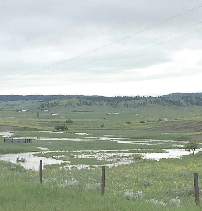
Heavy rains and flooding as two twisters touch down near Hulett
By Sarah Pridgeon
Two simultaneous tornadoes made landfall in the Goldie Divide and New Haven area last week, before splitting to travel in different directions. Both appear to have remained on the ground until reaching Hwy 112, where tree damage temporarily blocked the road.
Overall damage from the tornadoes is reported to have been limited to trees and two grain silos. No injuries were reported and no damage was found to infrastructure or homes.
According to the National Weather Service, the two tornadoes developed northwest of Hulett at around 8 p.m. on June 25. They dissipated four miles north-northwest of Hulett, having snapped and uprooted numerous pine and cottonwood trees.
According to Deputy Ed Robinson’s report, the National Weather Service tracked a severe thunderstorm west of Hulett and issued a severe thunderstorm warning. Just one minute later, a tornado warning was also issued based on tracks appearing in and around the New Haven and Goldie Divide areas.
The National Weather Service contacted the Sheriff’s Office dispatch and asked for weather spotters to be sent out. Crook County Deputy Fire Warden Jason Perry went out into the area of Hwy 112 near milepost 5.6 and reported that he could see the weather front and what appeared to be a tornado tracking across private property.
When it reached the road, Perry vacated the area but reported that it had gone back into the clouds and continued on towards Alva after downing trees on the property. He also reported that the landowners were unhurt.
Robinson responded to the area on the morning of June 26 to check for damage, assisted by Deputy Jason Robinson and Perry. He observed large trees down on the drive of the private property, which the landowners were in the process of removing.
The landowners reported that they had experienced hail approximately two inches in diameter along with high winds. They suggested there may have been two tornadoes since the damage indicated separate tracks.
Robinson found trees that had been uprooted and others that had snapped off. The latter, he reports, indicates a higher wind velocity of around 100 to 120 mph. Additionally, a grain silo had been moved off its foundation by the high winds.
Robinson also investigated damage at two ranches near New Haven, as well as near Goldie Divide. He met with representatives from the National Weather Service who were also investigating the tornadoes and believed they may have originated just west of New Haven; one appeared to have tracked to the north of the first property and the other to the south.
At one of the New Haven ranches, a section of metal roof was torn away. At the other, a grain silo and auger was picked up and deposited approximately a quarter mile to the east in some trees.
“The wind force here was evidently very strong having tipped over many large hay bales and thrown items around,” says Robinson in his report.
In an area between Goldie Divide and Horseshoe Road, many trees were laid down and destroyed where the tornadoes appear to have originated.
The National Weather Service estimates that both tornadoes followed paths around five miles in length and were a maximum of 100 yards in width. The estimated peak wind speed was 105 mph for both tornadoes, placing them at EF1 “Moderate” on the Enhanced Fujita Scale.
Storm reports from the time of the tornado show that hail fell north of Aladdin at a size of 1.75 inches and near New Haven at 1.5 inches. Large hail was also reported five miles north of Hulett and south of Lightning Flat.
Wind speeds east of Hulett and north-northwest of New Haven were measured at a speed of 60 mph. Radar images show that the storm supercell brought considerable cloud-to-ground lightning.
The following day, severe thunderstorms moved across the area, largely affecting western South Dakota but tipping over into the northeast of Wyoming. The storm brought damaging winds and caused power outages, with unusually strong winds ahead of the storm. In Crook County, high winds of 60 mph were reported near both Colony and Carlile.